Project Overview
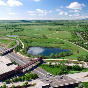
Bear Canyon Creek is located in the south end of Boulder and enters the city uphill of Table Mesa Drive. It includes a multi-use path, and is part of Boulder’s system of greenways.
Bear Canyon Creek is located in the south end of Boulder and enters the city uphill of Table Mesa Drive. It includes a multi-use path, and is part of Boulder’s system of greenways.
Bear Canyon Creek starts in City of Boulder Open Space and is about 6.3 miles in length and ranges in elevation from 6170 feet to 5235 feet. It flows north and joins with Boulder Creek near the Boulder Community Health Hospital site at Foothills and Arapahoe. The watershed associated with this creek is around 5.3 square miles.
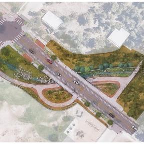
Beginning in July 2022, the city will be embarking on a creek restoration and stormwater infrastructure project along/near Bear Canyon Creek at Ithaca and Wildwood. The purpose of this project is to address damages caused during the Sept. 2013 storm and to improve stormwater drainage within the roadway.
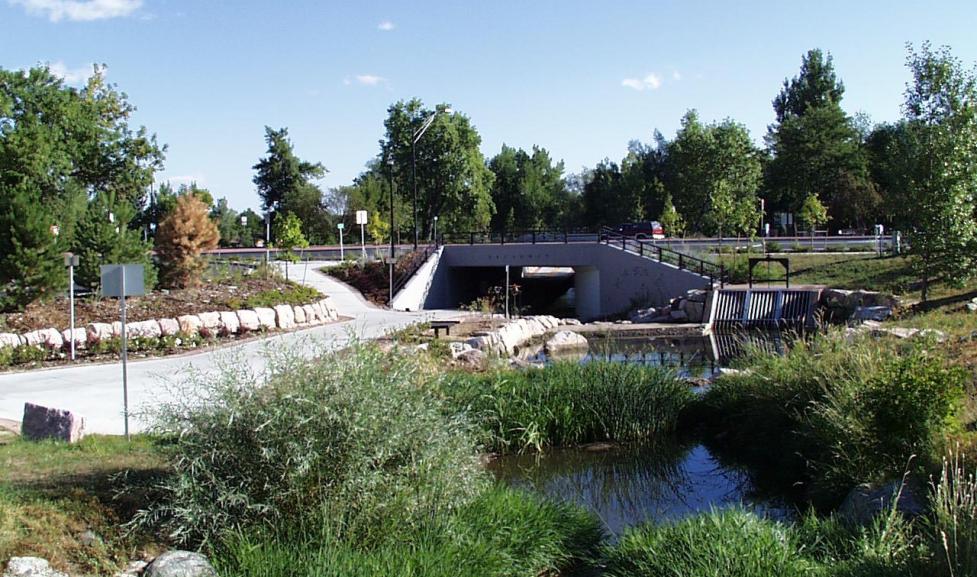
The Mile High Flood District, in partnership with the City of Boulder recently concluded a stream restoration project along Bear Canyon Creek east of the intersection of Foothills Parkway and Arapahoe Road.
This project's purpose was to improve stream function and conveyance.
The City of Boulder looked at opportunities for flood mitigation improvements along Bear Canyon Creek. Staff considered impacts from the September 2013 flooding, as well as the 100-year regulatory flood model and more frequent storm events.
City Council accepted the Bear Canyon Creek Flood Mitigation Plan PDF. Next steps include budgeting and scheduling improvements into the Capital Improvements Program.
AMEC Foster Wheeler has been hired as the project consultant team.
The City of Boulder has been updating the floodplain mapping for Bear Canyon Creek in south Boulder.
FEMA has accepted the updated floodplain mapping for the section of Bear Canyon Creek downstream of Colorado Ave PDF and the revised mapping is now in effect.
Floodplain mapping studies provide the basis for flood management by identifying the areas subject to flooding. This information is essential for determining areas where human safety is threatened and property damage is likely. Floodplain maps must be updated periodically to reflect changes in the floodplain resulting from land development, flood mitigation improvements and new study technologies.
This Letter of Map Revision (LOMR) was requested in 2014 to update a short reach of the Bear Canyon Creek floodplain. A LOMR is required to formalize flood mitigation improvements and to update hydraulic models.
The City previously submitted a LOMR for Bear Canyon Creek from Foothills Parkway (downstream) to the city limits (upstream) to reflect the numerous changes authorized by City floodplain permits and update hydraulic models based on better, more detailed topographic information. This LOMR was submitted to FEMA in 2002 and approved on February 27, 2003.
The study area for the current LOMR addresses the remainder of Bear Canyon Creek within the City limits, extending from the confluence of Bear Canyon Creek and Boulder Creek (downstream) to Foothills (upstream). This study includes the data and documentation required for accreditation of the Harrison Levee. The Harrison Levee is provisionally accredited on the current Flood Insurance Rate Maps. The LOMR will incorporate the updated hydraulic model for Boulder Creek at the downstream tie-in location as well as the additional culverts below Arapahoe Avenue that were installed to increase the flow of Bear Canyon Creek.